
The Significance of the Missouri River in American History
Before the railroads, before the interstate highways, before any of it, there was the river. The Missouri River carved a path through the continent so useful and so unavoidable that every major chapter of American expansion ran straight through it.
You can’t overstate what this waterway meant to the people who first pushed west. It isn’t just that the Missouri offered a route through the river valley. It’s that without it, much of what we call the American Midwest simply doesn’t develop the way it did, at the pace it did, by the people who got there first. French fur traders worked its banks in the 17th century, wrestling with unpredictable currents and volatile water levels in pursuit of animal pelts. National Academies of Sciences, Engineering, and Medicine reports that the mainstem Missouri River dams now store approximately 3.7 million acre-feet of sediment (about 6 trillion tons), and the dams and bank stabilization projects implemented over the centuries have contributed to a net reduction of half in the sediment delivered to the Gulf of Mexico. That transformation of the river’s sediment regime stands as a measure of just how thoroughly human activity has reshaped a waterway that once ran wild and ungoverned.
Those early journeys opened something, though. Contact with Native American tribes along the Missouri created networks of exchange that would outlast the fur trade itself. Cultural relationships formed, alliances shifted, and knowledge passed between peoples in ways that shaped how the entire region understood itself. By the time Lewis and Clark launched their now-famous expedition up the Missouri River in the early 19th century, they were following a corridor that already had history in it.
Early Explorations and Settlements along the River
Lewis and Clark’s mission was precise: map the territories acquired in the Louisiana Purchase and find a practical route to the Pacific. The Missouri River gave them their starting line. They followed it deep into the continent, and the maps and journals they produced changed how the United States understood its own geography. Settlement followed fast on the heels of exploration, and the river’s role shifted.
The fertile bottomlands of the Missouri valley attracted agricultural communities looking for reliable soil and access to trade routes. Towns and forts rose along the banks. Fort Peck and Fort Randall weren’t just military installations. They were anchors, supply points that made the leap westward survivable for settlers heading into what would become North Dakota and the broader Midwest.
These weren’t isolated outposts, either. They formed a connected system that tied the frontier to the eastern states, allowing goods, people, and information to move in both directions. Rivers like the Missouri didn’t just open the west. They kept the west in conversation with the east, threading the expanding nation together at a time when that thread could easily have snapped.
So the Missouri River did two things at once. It pulled people west and kept them tethered to what they’d left behind. That tension, between expansion and connection, between the unknown and the familiar, runs through the entire history of the river and the country it helped build. Today, you can still trace that legacy in the towns and landmarks that survive along its banks, physical evidence of a story the river made possible.
The River’s Unique Ecology and Wildlife
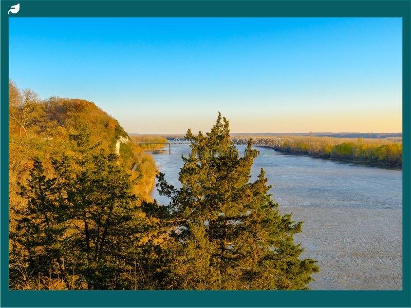
Here’s the thing about the Missouri River’s ecology: the variety is genuinely surprising. Dense riverside forests give way to sprawling wetlands. Sandbars appear and disappear with the seasons. The corridor supports fish, migratory birds, mammals, and plant communities that depend on each other in ways that took scientists decades to fully document.

It isn’t a simple river system. It’s a chain of overlapping habitats, each one sensitive to what happens upstream and downstream.
That complexity makes conservation both essential and difficult.
Protection Efforts and National Park Designations
National park designations along the Missouri River have been among the most effective tools for protecting this ecological corridor. Parks near Fort Peck and Fort Randall provide protected space where wildlife can breed, feed, and move without constant pressure from development. Migratory birds use these stretches as critical stopover points, some arriving from rivers and wetlands hundreds of miles to the east before continuing north or south along seasonal routes. Indigenous fish species, some of which have inhabited the river for thousands of years, depend on specific habitat conditions that only exist because certain sections have been left largely intact.
But protection isn’t just about fencing things off. The parks along the Missouri River have invested heavily in public education, and that matters. When visitors understand why a particular sandbar matters to a nesting bird, or why water quality in North Dakota affects fish populations hundreds of miles downstream, they become stakeholders. That broader public investment is what sustains conservation funding and political will over the long term.
In North Dakota specifically, the river runs through areas where conservation and community interest have had to find a working balance. Water management practices introduced in recent decades aim to maintain both water quality and reliable flow volumes, two things that don’t always pull in the same direction when agriculture, industry, and ecology all need the same resource. The fact that this balance has largely held says something about the seriousness with which local and federal bodies have approached the river’s future.
Park programs have also reached into local economies, supporting sustainable tourism that brings revenue to river communities without degrading the habitats those communities depend on. It’s not a perfect system. But it’s a working one, and the Missouri River’s ecological corridor is measurably healthier in protected zones than in unmanaged sections. That difference is the argument for continuing.
Navigational Challenges and Solutions
The Missouri River has never been an easy river to use. Its water levels fluctuate dramatically. Its currents in the Upper Missouri can shift without warning. The sediment loads that gave the river its old nickname, the Big Muddy, complicate everything from channel depth to equipment maintenance. Missouri Sedimentation Action Coalition reports that the US Army Corps of Engineers estimates that 75,545 acre-feet of sediment enter the river’s reservoirs annually, and in September 2024 a 12-foot bedload collector reduced the sediment load reaching the Lewis and Clark Lake delta for nearly one week, illustrating both the scale of the challenge and the ingenuity of emerging solutions.
For anyone moving cargo or passengers along this waterway, these aren’t abstract problems. They’re daily operational realities.

Modern Developments in River Transport
The most significant recent change in how people navigate the Missouri River is data. Hydrological forecasting has advanced to the point where transport authorities can predict water levels and flow patterns across the river basin with real precision. Real-time monitoring devices placed along the river feed continuous information into management systems, allowing for adaptive decisions about traffic routing and channel maintenance. That shift from reactive to predictive management has made the navigation system along the Missouri genuinely more reliable than it was even two decades ago.
Environmental sensors contribute to this picture too. They track water conditions throughout the Upper Missouri, where the river’s natural unpredictability poses the greatest challenge for transport vessels. When conditions change, operators know before they hit the problem rather than after. That’s not a small improvement.
It’s the difference between a delay and a disaster.
Engineering has kept pace with the data. Modern lock and dam constructions along the Missouri River have brought a degree of flow control that earlier river users would have found extraordinary. These structures help regulate water levels across stretches that were historically nearly unnavigable at certain times of year. Flat-bottomed vessels designed specifically for the river’s shallower sections have expanded the range of routes available, making the Missouri viable as a transport corridor for a wider variety of cargo.
GPS technology and automated navigation tools have also cut fuel consumption and reduced the environmental footprint of commercial traffic on the river. That matters not just for operating costs but for the health of the river system itself. Vessels that run cleaner routes, optimized for both efficiency and water conditions, put less stress on the habitats lining the banks.
Public and private partnerships have been central to all of this. No single agency manages the Missouri River’s transport network. It takes coordination between local communities, state governments, federal bodies, and private operators to keep the system functioning. That collaboration is often slow and occasionally contentious, but it has produced a river transport network that is, by any practical measure, better equipped to handle the Missouri’s challenges than at any previous point in history.
Recreational Activities on the Great Missouri River
The Missouri River isn’t just for cargo and conservation. If you’re an outdoor enthusiast and you haven’t put this river on your map, you’re missing one of the genuinely great recreational corridors in the country. Kayaking, fishing, hiking, wildlife photography: the river offers all of it, across landscapes that shift dramatically as you move from one section to the next. Plenty of rivers across America offer one or two of those things.
Suggested Itineraries for Outdoor Enthusiasts
The Upper Missouri River Breaks National Monument is the obvious starting point for anyone serious about experiencing the river at its most spectacular. The landscape here is raw and unhurried. Hiking trails deliver sweeping views of the river valley, and the wildlife density is high enough that a patient observer with a decent camera will come back with something worth showing. Bald eagles aren’t rare here.

Kayaking the Missouri is a different experience depending on where you put in. Starting at Three Forks, where the river originates, gives you access to the full range of the Missouri’s moods. The gentler stretches are ideal for beginners or anyone who wants to drift past riverbanks thick with native plant life and watch for wildlife without fighting the current. The Big Muddy segment offers something harder and faster for paddlers who want a real challenge, with natural obstacles that demand attention and reward skill.
If you’ve paddled other rivers and found them too tame, this stretch will fix that.
Fishing on the Missouri River holds up across the whole system. Catfish, walleye, and largemouth bass populate the river in numbers that keep serious anglers coming back. The oxbow lakes scattered through the Missouri River basin are particular favorites, calm and productive and easier to work than the main channel. A guided fishing tour is worth considering if you’re new to the river.
For visitors who want history with their outdoor experience, the Lewis and Clark Interpretive Centers along the Missouri provide that grounding. These aren’t dry exhibits. They put you inside the physical reality of what that expedition faced and accomplished, with the river itself visible through the windows as a reminder that the story happened right here, on this water, at this bend. A trip that combines time on the river with stops at historical sites gives you the full picture of why the Missouri matters and why it continues to draw people from across the country.
Cultural Impact of the Missouri River in American Life
The Missouri River stretches more than 2,300 miles. But its cultural reach goes further than any map can show. For the Native American tribes who lived along its banks long before European contact, the river wasn’t a resource to be exploited. It was the organizing principle of daily life, the source of food, the route of travel, the center of spiritual practice, and the place where communities gathered to make decisions that mattered.
Central Role in Native American Culture
The Sioux, Mandan, Hidatsa, and Arikara peoples all built their cultures in relationship with the Missouri River, and the relationship ran deep. The river delivered fish and drew game to its banks, providing the nutritional foundation that allowed these communities to thrive. Seasonal flooding deposited rich sediment across the bottomlands, making the soil productive enough to support crops of corn, beans, and squash that fed entire nations across generations.
But the river’s role wasn’t only practical. It carried spiritual weight. Ceremonies and rituals were oriented around the river as a living presence, not a backdrop. Oral traditions passed down through families and communities described the Missouri as a force with its own character and its own demands, something to be respected rather than simply used.
The river’s banks served as gathering places for tribal councils, trade negotiations, and peace talks. Communities that might otherwise have had limited contact came together along the Missouri, and the exchanges that happened there, of goods, of ideas, of marriages and alliances, helped build the complex social fabric of the region’s Indigenous nations. Other rivers in the region served as boundaries or trade routes, but the Missouri was different. It was the center, the reference point around which entire cultures organized their understanding of geography, season, and identity.